


Story
SoWal Guide for the Amazing Scenic 30A Bike Trail
November 1, 2016 by SoWal Staff

There’s no better way to get up close and personal with South Walton's beauty and charm than to pedal along our paved 18-mile bike path. It winds past rare coastal dune lakes, stellar state parks, massive dunes, and through several charming SoWal beach towns. Biking in SoWal is a perfect family activity, an ideal way to get some exercise, and a whole lot of fun.
The bike path is oficially known as the Timpoochee Trail. Iit was named after an influential Euchee Indian Chief and runs the entire length of Scenic 30A from Santa Rosa Beach on the west end, to Inlet Beach on the east end. It's safe, wide, and relatively flat.
Rental bikes are available from several shops along the trail. Established SoWal businesses like Big Daddy's Bike Shop will deliver bikes anywhere, and pick them up also. The staff is a wealth of local info and resources. You can rent by the day, but you might want to rent bikes for the whole week. After one ride along the bike path, your bike may become the preferred mode of transportation at the beach.
Here’s a mile-by-mile guide to the bike trail, from west to east. Be sure to take sunscreen, sunglasses, a bottle of water, and a camera. You’ll need them all!
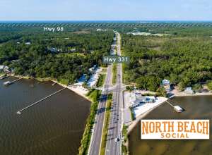
MILE 0 – The trail begins on the west side of Scenic 30A where it intersects with US Highway 98 in Santa Rosa Beach. There’s a mini-mart in case you need some supplies or snacks for your bike ride.

Heading west you'll first see the entrance to Topsail Hill Preserve State Park on your right. It cost two dollars for a bike rider to enter and if you’ve got the time, it’s definitely worth the side trip (or to come back to later). A set of bike/walking trails in the park will take you back to our beautiful beach, or you can wind through the old growth coastal forests and three coastal dune lakes that make this state park a coastal jewel. Plus there are bathrooms, drinking fountains, and a camp store here for any pit stops you need to make.
MILE 1 – You’ll see the first milepost just before you get to Butler Elementary in Santa Rosa Beach, and soon after that you’ll pass by Stallworth Lake, the first of several dune lakes you’ll get to see on the bike trail. A short distance later on the shore of Allen Lake you’ll get to Stinky’s Fish Camp, a favorite restaurant/watering hole for both locals and visitors.
MILE 2 – The trail crosses to the Gulf side of Scenic 30A for a short time at Dune Allen Beach Access, your first chance for a glimpse of the Gulf of Mexico from the trail, and another place to re-fill your water bottle or use the restroom. Then, the trail crosses back to the north side of the road at Oyster Lake, and about a half-mile later there’s another mini-mart on your left where you can find more snacks and/or drinks.
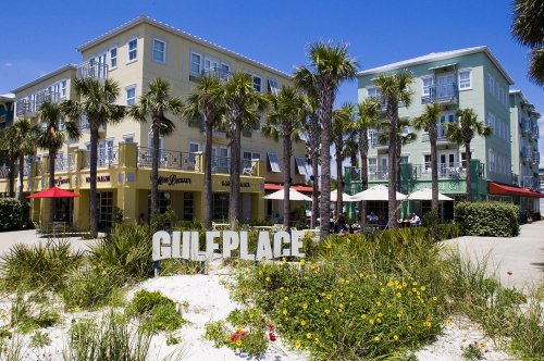
MILE 3 – When you arrive at the three-mile marker, you’ve reached a large group of shops and restaurants at Gulf Place, at the intersection of Scenic 30A and State Road 393. Here, you’ll find plenty of places to stop, shop, and eat.
The trail once again crosses to the Gulf side at the Ed Walline Beach Access, another large access point with restrooms, fountains, and a viewing tower that’s ideal for great pictures of the white sand and turquoise water.
MILE 4 – If you’re starting to get hungry, you’ve got a couple of options after the fourth mile of your trek. Local Catch Bar & Grill is one of SoWal's favorite eateries and sits directly in front of the Mile 4 marker. If you’re more in the mood for Asian cooking, Basmati’s Asian Cuisine sits just off the trail about half a mile further.

Between the two restaurants, be sure to stop and take a shot of the picturesque covered bridge that carries the trail over Draper Lake, another one of South Walton’s rare coastal dune lakes. The bridge makes a great backdrop for a group biking portrait.
MILE 5 – At Milepost 5 of the trail, you’ve reached the community of Blue Mountain Beach, and you might notice a slight incline as you enter the area. The area was named “Blue Mountain” because the tall dunes along the Gulf of Mexico are at times covered with the flowers of the Blue Lupine, a flowering plant you can still see in some spots around here.

You’ll also see several places that might tempt you to stop in for a snack or a meal. Among them are La Loba’s Bakery, famous for its organic cinnamon rolls, the Blue Mountain Beach Creamery, with plenty of cool frozen treats for a warm day, and a fantastic juice and smoothie bar at For The Health Of It Market. Down the hill is Big Redfish Lake on the right and left.
MILE 6 – You’re about a third of the way through the trail now, and you’re already about to see your sixth coastal dune lake. Little Redfish Lake is just off the trail to the right. Believe it or not, lakes like this are quite rare in the world. There are 15 named dune lakes in South Walton, but the only other places you’ll find them are in Madagascar, New Zealand, Australia, and Oregon. When the lakes get too full due to rain, an “outfall” opens up between the lake and the Gulf of Mexico to transfer water between the two. Once the lake has reached equilibrium, the outfall closes up again.
MILE 7 – When you see the 7-mile marker, you’ll pass Alligator Lake, as well as an entrance to Grayton Beach State Park (the main entrance is another mile down the trail). The park includes another long strip of beautiful beachfront, access to Western Lake, and plenty of biking and hiking trails. You may even like it enough to want to stay here, in which case the park has both campsites and fully furnished cabins.

At about mile 7.7, you’ll come to the intersection of Scenic 30A and Highway 283 (DeFuniak Street). Now, you’ve got a choice to make. If you take a right on 283, you can explore the community of Grayton Beach, including the famous Red Bar. Take a left, and you’ll find The Shops of Grayton, with its artsy little shops and the Hurricane Oyster Bar. Stay on the Timpoochee Trail just a bit further and you’ll reach Uptown Grayton which includes more restaurants, shops, and a coffee shop.

MILE 8 – After passing Grayton Beach, your next big point of interest is Western Lake. Looking right you can see all the way to the beach, and on a nice day you’re likely to see people enjoying the lake on kayak, canoe, or standup paddle board. If you’re interested, you can rent a boat or board at The BoatHouse in WaterColor (head north to the lake at WaterColor town center).

MILE 9 – Once you cross the last bridge over Western Lake, you’ll see the entrance to WaterColor, another of South Walton’s unique beach towns. WaterColor has great options for refreshments or shopping, and if you’ve got time for a side trip, take a left onto Watercolor Boulevard and explore this beautiful community that virtually blends into its natural surroundings. The bridge over Western Lake, with its charming solar cattail lights, is a popular photo spot.
The trail crosses to the north side of Scenic 30A here, and right after leaving WaterColor, you’ll be entering Seaside - the beautiful beach town that took a starring role in the film “The Truman Show”. Stay on the trail and you’ll soon be biking through Seaside Central Square, a perfect place to take a break and grab lunch or a snack from one of the food trucks on Airstream Row or the shops and restaurants in the square.

If you’ve still got some energy, it’s well worth the time to take your bike behind the square and explore some of Seaside’s picturesque neighborhoods. The Shops of Ruskin, the Seaside Chapel, and the pastel-colored homes on tree-lined streets are all iconic images of Seaside that many visitors love to experience and photograph.
MILE 10 - Once you’ve gone through Seaside, you quickly come to Seagrove Beach and the intersection of Scenic 30A and Hwy 395. There’s another bike trail that leads to the north towards Point Washington State Forest.
MILE 11 – Several chances for rest breaks will greet you after you pass the mile marker in Seagrove. There’s a small shopping center with a few restaurants and shops at the 11.4 mile mark, followed quickly by a gas station and convenience mart, then by Angelina’s Pizzeria & Pasta, a local favorite for Italian food in South Walton.
MILE 12 – After crossing over Seawater Drive at the milepost, you’ll be starting the final third of the trail with a nice view of Eastern Lake.
MILE 13 – At about the 13.6 mile mark, you’ll see Deer Lake, followed closely by the entrance to Deer Lake State Park, another part of the South Walton ecosystem protected from development. Among the favorite activities here are biking, fishing, exploring the coastal dune habitat and enjoying pristine Gulf beaches.

MILE 14 – Almost immediately after Deer Lake, you'll reach the entrance to WaterSound Beach, one of the quieter beach towns in South Walton. Much of the beachfront in WaterSound Beach is undeveloped with wide, wooden boardwalks winding among giant, rolling dunes.
MILE 15 – Last chance for a pretty picture of a dune lake along the trail. There’s a great view of Camp Creek Lake at about 15.2 miles. The WaterSound Beach pedestrian bridge over the lake stands out and makes for a stunning photograph, especially at sunset.

MILE 16 – At this point of the trail you’ll enter Seacrest, one of the oldest coastal neighborhoods in SoWal. Years ago, before Alys Beach and Rosemary Beach were developed, Seacrest was kind of out in the boonies.

MILE 17 – The iconic white butteries and stately line of palm trees along Scenic 30A is a sure sign you’re in Alys Beach, and it’s a great place to get off the trail and explore for a little while. Alys Beach is known for it’s stately, all-white, Caribbean and Mediterranean architecture. Check out the nature trail on the north side of Alys Beach that winds through a cypress swamp. And if you’re hungry or thirsty, local favorites Fonville Press and George’s at Alys Beach are both just off Scenic 30A.
Just past Alys Beach you'll see the condos, shops, and restaurants at the Village of South Walton, and here you’ll find a few more great opportunities for refreshment. If you’re looking for something tasty, La Cocina Mexican Bar & Grill serves up great Tex-Mex cuisine with a coastal twist.
Heading east again, you’ll move to the island-style of Rosemary Beach, which is also worth a side trip off the trail. If you’ve got the time, browse through the shops and galleries of downtown Rosemary, and take a few moments to check out the Butterfly Garden on the north side of the community. The cool green grass of the Gulf front parks at Rosemary Beach are not to be missed, and provide a great place for a picnic. There are several excellent food options here.

MILE 18 – You’ll pass the final mile marker just after leaving Rosemary Beach, and about half a mile later, the trail ends in Inlet Beach at the doorstep of Shade’s Bar & Grill. Celebrate your completion of the trail here, or wander back onto the streets of Inlet Beach for some stunning views of the Gulf to put an exclamation point on an amazing 18-mile bike ride and another great day at the beach.

Video
Tagged

Offering news, features, insider tips & info, photos and video all across the South Walton area.


