• Trouble logging in? Send us a message with your username and/or email address for help.
New posts

SoWalSally

Beach Fanatic
Feb 19, 2005
649
49
A letter from Bonnie McQuiston

I read with dismay the revision of history in SWCC celebrates 10 years in community.

In 1995, Wally Bair and members of the Walton Taxpayers Association discussed the formation of a subsidiary organization south of the Choctawhatchee Bay. It was Wally's idea to unify South Walton's small communities to address the uncontrolled private development occurring at that time.

The mission of the Taxpayers Association, organized in 1982, was dedicated to local tax issues. Since the new organization's mission focused on development and protecting neighborhood communities, a separate independent entity was formed, hence the South Walton Community Council.

Walton County had refused to adopt a comprehensive plan since 1985 when state law required all Florida counties to have a plan. In 1992, the state of Florida purchased 18,000 acres of environmentally natural land in South Walton with Preservation 2000 money. The state allotted $800,000 for the development of a South Walton Conservation and Development Trust Plan.

The state and Walton County appointed a panel which, along with dozens of local citizens, developed the Trust Plan.

The entire process lasted more than three years and, ultimately, cost the state more than $1 million. Upon completion, Walton County commissioners refused to adopt the Trust Plan. During the entire Trust Plan process, developers frantically received approval for development while there were no restrictions or limitations.

It was at this critical time that Wally Bair organized the SWCC which he then led for many years with others who had been involved in the Trust Plan development. Today, under the leadership of Executive Director Anita Page and President Bob Dobes, the SWCC continues to address incompatible development in neighborhoods and to work with the county on the ever-evolving Comprehensive Plan and Land Development Code.

In 1995, the coastal conservation group Beach to Bay Connection was formed to protect all state preservation land in south Walton County. Charter members of Beach to Bay Connection had participated in the lengthy Trust Plan process and witnessed the targeting of more than 3,000 acres of preservation land for private development. It was Beach to Bay members who regularly traveled to Tallahassee to speak before the governor and cabinet about the promise to the people of Florida to keep preservation land from development.

In August 1996 at Beach to Bay's request, a state delegation traveled to Walton County and held a public hearing. An overflowing crowd from all over Walton County spilled out of the Point Washington school onto the lawn, reportedly the largest gathering for a public hearing in Florida history.

The message to the state was loud and clear: Do not develop preservation land.

Two months later, a lame duck Walton County commission adopted a Comprehensive Plan which included the Trust Plan.

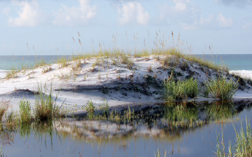
Today, many new property owners and visitors enjoy South Walton County's unique character, identified by development balanced with the natural environment of our state forest and park. They have no idea of the blood, sweat and tears shed to maintain the county's uniqueness and natural beauty.

While recognizing SWCC's anniversary, we must pay tribute to all of the people and to Beach to Bay Connection who dedicated hours, months and years doing whatever it took to protect this special place we call paradise.
 
Last edited by a moderator:

Kurt

Admin
Staff member
Oct 15, 2004
2,234
4,926
SoWal
mooncreek.com
Reviving this 2005 thread to add some SoWal history of planning and conservation.

Approximately 40 percent of South Walton's 56,000 acres is in conservation, protected from future development – 25,000 acres of untouched property where native wildlife thrive.

The South Walton Conservation and Development Trust, comprised of a 12-member panel, was established by the State Legislature in 1994 and charged with preparing an overall environmental survey of South Walton's 56,000 acres and recommending development plans that will economically and environmentally enhance South Walton.

This produced a blueprint for thoughtful future development through 2025. Walton County adopted a Comprehensive Plan for future development, which includes:
  • Striking a balance between on-going growth and development, and careful preservation of the natural resources
  • Stringent building codes - including a four story height restriction
  • Sea oat plantings and other restorative programs


Kurt

Admin
Staff member
Oct 15, 2004
2,234
4,926
SoWal
mooncreek.com


Written in 2005 by Tiana Larsen and originally published in the Defuniak Herald Beach Breeze

Much of the story of the acquisition of the Point Washington State Forest has been forgotten or altered in the telling during the 13 years since the state purchased the land.

Virtually unknown to new residents of south Walton, the history of the acquisition of the 18,000-plus acres is a fascinating saga with elements of high drama, shady characters, foreign investors, and political intrigue. The story crosses the country from Texas banks to Washington D.C. to the steps of the Walton County Courthouse and to hearing rooms in Tallahassee.

History of the Purchase:

Most of the land, including pristine beachfront now included in Topsail Hill State Preserve, was owned by St. Joe, which was then known as the St. Joe Paper Company.

In 1986, a development company, Emerald Coast Joint Venture, bought most of the land from St. Joe and announced plans for hotels, homes, golf courses, and even an airport.

Before anything was built, however, the company's finances collapsed, leaving behind a morass of documents, related corporations, side deals, and complicated loans.

In September of 1991, a grand jury impaneled by the U.S. District Court for the Northern Division of Florida returned a 115-page, 15-count indictment against 14 defendants involved with Emerald Coast Joint Venture.


Charges included conspiracy, bank fraud, mail fraud, and money laundering. A five-month trial resulted in a number of convictions and jail terms.

Two savings and loans in Pennsylvania and Texas allegedly lost $102 million on the deal, and when they bankrupted, the land ended up in the hands of the Resolution Trust Corporation (RTC). (The RTC was the organization set up in 1989 by the federal government to dispose of assets of failed thrift institutions.)


In May of 1992, the RTC auctioned off its entire south Walton holdings, in an all or-nothing package. The State of Florida, which had long been interested in acquiring the Topsail property, bought it all, through the Nature Conservancy, literally at the eleventh hour, at an auction on the Walton County Courthouse steps.


A little-known fact about the purchase is that of the 18,320 acres, 17,672 acres were on the state's wish list of properties to purchase for conservation, the Conservation and Recreation Lands (CARL) list. Although the Topsail Hill property was the state’s top priority, the Pt. Washington forest acreage had also been added to the list, in 1990.

Florida Fish & Game (now the Florida Fish & Wildlife Conservation Commission) sponsored the original Pt. Washington Forest project, which went through a number of state studies before being added to the CARL list.


At the time it was added, it was low on the list for two reasons, according to Ruark Cleary, a state biologist who worked on the project with the state Conservation and Recreation Lands Trust. It was a larger project than the state was used to working with, and at the time, there was no reason to think that the property would be available for purchase by the state.

Roark said that the agency’s vision at the time was to obtain the Pt. Washington land and the Topsail Hill land, and combine them into an ecosystem project that could tie into Water Management District land in the Choctawhatchee River basin. According to Cleary, “there is nothing in the record to support the idea that the state only wanted Topsail and never wanted the Pt. Washington tract,” an idea that still surfaces from time to time.


Another little known fact is that there was once a “Point-Washington Phase II” project that involved an additional 10,000 acres that would be used to create a greenway all the way from Georgia to the Gulf in the eastern end of Walton County. Phase II, however, never made it past the idea stage, in part because of the political climate in Walton County, which was unfavorable for large state land purchases.

The state bought the property with $20 million in Preservation 2000 funds, the 10 year program begun in 1990 to purchase and preserve environmentally special land. Another $90 million or so was spent to acquire the portion of Topsail Hill that was retained by St. Joe and later purchased through eminent domain proceedings.


The Walton County Commission went on record at the time as opposing the purchase by the state, with the primary objections being the removal of land from the county's tax rolls and the loss of future potential private development.


The county's opposition and other events taking place at the same time set the stage for a confrontation between the county, development interests, and citizens’ conservation organizations that would not be resolved until a Cabinet meeting in Tallahassee four and one-half years later.

In 1985, the state passed the Growth Management Act, which required all counties in the state to adopt comprehensive plans. In 1992, when the state land purchase took place, the county still did not have a compliant plan. At this point, the state stepped in with funding and a legislatively created entity, the South Walton Conservation and Development Trust.


The Trust was charged with creating a comprehensive plan, performing an environmental analysis of the ecosystem, creating greenways linking preservation areas and parks, providing for affordable housing, and so forth.


Part of its mission was the creation of an acquisition and disposition plan for state owned land. The concept of this aspect of the plan was to clean up conservation borders using disposition of undesirable, isolated parcels and to acquire privately held parcels within the conservation boundary. The final Trust recommendation was for the disposition of nearly 3000 acres, and the acquisition of about 500 acres.


Walton County, meanwhile, was continuing to lobby for more land to be sold off by the state and made available for commercial development. The Ecosystem Management Team, an implementation panel set up with the county's blessing to follow up on the Trust’s work, made a recommendation that the state dispose of land for the New Town center on Hwy. 331, now the Government and Education Center. The original New Town proposal was for considerably more acreage, and included housing and commercial development.


Also included in the team's disposition recommendation were three environmentally sensitive parcels that were contiguous with state land and did not appear to meet the disposition criteria. These included 245 acres in Seagrove containing the Cassine Gardens Cypress Swamp Nature Trail, and an 80-acre parcel in Blue Mountain Beach at the headwaters of Redfish Lake.


In July of 1996, community members learned that the state's Land Acquisition and Advisory Council was going to approve redrawing the conservation map without public hearings. All the land left outside the new boundaries, including New Town and the Cassine Trail, would be “surplus,” and available for sale to private interests or the county.


The conservation organization Beach to Bay Connection asked for a public hearing in south Walton. Over 500 local residents turned out at Bay Elementary for a standing room only meeting on a hot summer night, and nearly unanimously expressed a desire to retain all the state lands for conservation.

After another series of meetings in Tallahassee, the amount of the disposition acreage was reduced, as was the size of the New Town site, which was modified to limit its uses to civic services such as government and education, and the Cassine Trail was saved from development.


The Forest Today (2005)

The Pt. Washington State Forest today consists of 15,258 acres. The other 3000 acres from the original purchase were transferred into the state park system and are included in Deer Lake, Grayton, and Topsail Hill State Parks.


Since the purchase ten years ago, about 1.7 million longleaf pine seedlings have been planted, according to Tom Beitzel, of the State Division of Forestry, the managing agency for the forest.

This replanting is the biggest accomplishment towards restoration, Beitzel said. Most of these have been planted on about 1800 acres. The rest of the forest is reseeding itself, or consists of smaller parcels that have not been cut. When the state purchased the land, it was pretty well cut over, Beitzel noted.


The longleaf pine community comprises a large part of the Pt. Washington forest. These forests once covered over 70 million acres of the Southern U.S. from Virginia to Texas. In 1714 the water-powered sawmill was invented, and by the 1760s there were hundreds of these operating along streams and rivers all over the south. Timbering and turpentining left much of the forest weakened, and what remained was finished off by the second wave of logging from about 1870 to the 1920’s, when nearly all that remained was logged with the help of steam sawmills and railroads.


Many of the remnants of longleaf that survived are in areas where fire has been suppressed. Lack of fire allows hardwoods and other plants to grow too tall and thick in the under story of the pines. The increased shade eliminates the native wiregrass and other plants normally found in the longleaf forests, which would naturally be quite open.


Beitzel is happy with the return of fire to the forest. In the old days, the coastal plain had large areas without any natural firebreaks, such as a large body of water or extensive wetlands. A lightening ignited fire in this area could burn a significant part of the forest, or, without firefighters to suppress them, many small fires burning at the same time could do the same thing.


Without fire, the natural plant communities are altered, and along with them, the animals that depend on the habitat also disappear. Beitzel has instituted a prescribed burn program on about 10,000 acres of the forest. The western part of the forest, which is still a mosaic of smaller, unconnected parcels, is more difficult to burn because of the proximity to homes.


The state has bought some additional acres in this mosaic and closed up a couple of places. An effort to consolidate the forest holdings and sell the surplus lands is still ongoing, with land trade negotiations underway. Recently a parcel on East Hewitt where an eagle’s nest is located was added to the forest. This parcel also provides a second area where the forest touches the Choctawhatchee Bay, with the other being just west of Don Bishop Road.


When St. Joe owned the land, it was included, by agreement with St. Joe, in the Pt. Washington Wildlife Management Area. However, during the period of other private ownership after St. Joe, there were private hunting clubs that mostly hunted the area out.


Since then, deer have returned to the forest. The Florida Wildlife Commission co-manages the area along with the Division of Forestry, and manages hunting in the forest, which is allowed on about 12,000 acres.


Some rare species found in the forest include the gopher tortoise (gopher tortoise burrows are used by many other species), flatwoods salamander, white-topped pitcher plant, and the world's largest population of Curtiss sandgrass, a rare native grass.


Trails and Recreation

The forest is also used for off-road bicycling and hiking. The Eastern Lake Trail, dedicated in 1996, is accessible from a trailhead parking lot located on CR395, between C30A and Hwy. 98. This trail consists of three double loops of three-and-one-half, five, or ten miles. The Cassine trail and a view of the headwaters of Eastern Lake are located on the southern section of the trail.

The Longleaf Greenway Trail is the latest one to be completed. This trail starts on CR395, on the opposite side of the road from the Eastern Lake trailhead parking lot, and runs west all the way to Satinwood Drive in Blue Mountain Beach.

It is eight miles long, and crosses several county roads that connect to the C30A bike path. These can be followed to provide a loop trail to return bike riders to the parking lot on CR395. Maps of the trails and forest information can be found at the trailhead parking lot.

Much of the work on the trails has been done by volunteers from Beach to Bay Connection, working with Forestry staff. Chair Celeste Cobena, who had a vision of trails linking the parks, the forest, the beach and the bay, remarked recently that those trails are now a reality.

“The big worry now is that we will see pressure for roads through the forest. It is important we don't lose the forest,” Cobena said.

An 11-mile, double-loop trail for horses is under construction off Bay Drive, north of US 98. The parking lot has been completed, but the trail itself, which requires two bridges, has not been completed. Construction fell behind in the wake of Hurricane Ivan.

In the coming years, some of the longleaf pines planted will need thinning and will be big enough to sell. Beitzel hopes to be able to do some timber marketing, with a high-quality, high-demand product that will generate some income. So far, he said, $118,000 has been realized from timber sales. In lieu of property taxes, ten percent of this income goes to the Walton County School Board.

Ten percent, or $75,000, of another recent sale also went to the school district. Sand from the dredging of the Intracoastal Waterway onto banks within the forest was sold for S500,000, for fisi used in the widening of US 98.

Beitzel hopes to complete more trails, and also continue the restoration of the forest ecology, removing more slash and sand pines that have taken over some areas in the absence of fire.
 

Kurt

Admin
Staff member
Oct 15, 2004
2,234
4,926
SoWal
mooncreek.com

Walton County attracts visitors as a place to relax, unwind and rejuvenate. From the turquoise waters, up the white sand dunes, and to the north which contains the highest point in Florida, Walton County is known for its diversity and preserves.


Home to Florida’s 15 coastal dune lakes, a rare phenomenon that can only been seen in 4 other places in the world – Australia, New Zealand, Madagascar, and Oregon. These shallow lakes are estimated to have been formed between 2,000 and 10,000 years ago. Created when sand is redistributed by wind, they’re now separated by large sand dunes that are up to 30 feet tall but connect and exchange water intermittently with the Gulf of Mexico through an outlet.


Three state parks now retain some these unique lakes - Topsail Hill Preserve state park, Grayton Beach state park, and Deer Lake state park. Including miles of pristine coastline, large sand dunes, nature trails, and excellent fishing, these state parks preserve ecosystems that are home to 13 imperiled species, which include the Choctawhatchee beach mouse and rare carnivorous pitcher plants.


In the northern end of Walton County, sits the highest point in Florida. At 345 feet, Lakewood Park is home to the lowest-high point out of any states. While you won’t need any mountaineering gear to get to the monument, do bring some hiking shoes and explore the nature trails surrounding this area for a different side of Florida.


The Choctawhatchee Bay covers approximately 129 square miles within Okaloosa and Walton counties. With the coastline riming this estuary, you can find forested wetlands, oyster beds, endangered Okaloosa darters, bony-plated Gulf sturgeon, alligator, gar, rare snails, reptiles and amphibians. The huge bay along with the Choctawhatchee River, Intracoastal Waterway and Gulf of Mexico offer excellent grouper, trout and snapper fishing.


Overlooking Choctawhatchee Bay, Eden Gardens State Park offers a glimpse into the area's past of lumbering, turpentine production, agriculture and fishing. Its special attraction, Wesley Mansion, once a lumber baron's antebellum home, is surrounded by camellias, azaleas and butterfly gardens.


The white sand beaches of South Walton are scattered with 16 smaller beach communities all of which have their own tasteful flare. Partake in their rich histories, unique art galleries, adventurous water activities, and award-winning cuisine, you can find something for everyone here.


Deer Lake State Park1,995 acres
Eden Gardens State Park163 acres
Grayton Beach State Parks2,228 acres
Ponce de Leon Springs State Park386 acres
Topsail Hill Preserve State Park1,640 acres
Point Washington State Forest15,407 acres
 

Kurt

Admin
Staff member
Oct 15, 2004
2,234
4,926
SoWal
mooncreek.com

As our community grows, many residents and visitors continue to be in awe of the extraordinary amount of recreation land we have in South Walton county. However, some newcomers have no idea how we acquired such a vast and beautiful landscape enjoyed by many.

Topsail Hill Preserve State Park and Point Washington State Forest almost didn’t happen. Thanks to the support from organizations such as The Nature Conservancy, an energetic group of advocates from 4-Mile Village, local conservation group Beach To Bay Connection, and passionate Santa Rosa Beach residents thank goodness it did, and it came down to an earnest, last minute effort by Nature Conservancy purchasing 15,000 acres of land on the Walton County courthouse steps on May 19, 1992.

“Twenty-five years ago today Point Washington State Forest was purchased along with the first parcel of land at Topsail Preserve. May 19 should be a national holiday in South Walton. Imagine the forest as developed, there were people back in 1992 who did. The small but mighty community spent years making sure thousands of acres of our forest and state parks were not sold or given to the county or developers,” said Celeste Cobena, Santa Rosa Beach resident and conservation advocate.

The history of the Topsail Hill Preserve State Park reads like a Carl Hiassen novel. Savings and loan disasters, shady transactions, foreclosures, and local government opposition dot the trail to what would eventually become a beloved jewel for Walton county residents and visitors:

1925 – Alfred duPont purchases land in South Walton for $11/acre.

1936 – St. Joe Paper Company is formed. Holdings in Topsail total 21,000 acres including six miles of beachfront.

1981 – Jacob Belin, St. Joe CEO, proposes turning Topsail Hill property into “The playground of America,” proposing a golf course and marina.

1984 – St. Joe Paper puts Topsail Hill land on market.

1986 – William Michael Adkinson, a Panhandle native turned developer, then living in Texas, Keith Alan Cox, a London attorney, and their associates offer to buy 20,800 acres under the company name Development Group Inc. for $182 million from St. Joe Paper. At the time it was the most expensive real estate deal in Florida’s history. Their marketing report showed big plans for the land: a barge port, condos, hotels, golf courses, airport, schools, theme park, and more. A portion of the mortgage was held by St. Joe Paper.

1987 – Development Group fails to make payment. Loans from Texas based Vision Banc and Hill Financial Savings in Pennsylvania fail. St. Joe Paper forecloses and regains possession of 780 acres of beachfront. The remaining acres are put under management of Resolution Trust Corp., (RTC), (the agency created to clean up the savings and loan institution mess), handling the aftermath of the savings and loan crisis that encompassed several institutions nationwide.

1988 – Topsail Hill land is now comprised of approximately seven ownerships.

1989 – RTC files suit in U.S. District Court in Pensacola seeking foreclosure on the joint ventures’ Topsail holdings.

1990 – Florida Legislature passed of the landmark Preservation 2000 Act. This act anticipated the sale of $3 billion in bonds over a ten-year period, $300 million per year, from 1991 – 2000. The funds were to be given to the CARL program (50 percent), the Save Our Rivers programs of the five water management districts (30 percent), a newly-created Florida Communities Trust aimed at helping local governments (10 percent), 2.9 percent each to the Division of Recreation and Parks, the Florida Game and Fresh Water Fish Commission, and the Division of Forestry to purchase inholdings and additions to State Parks, Wildlife Management Areas and State Forests, respectively, and finally 1.3 percent for recreational trails.

1990 – 1991- The Land Acquisition Advisory Council (LAAC) acquires several parcels and transfers tracts to the Save Our Coast (SOC) and Conservation and Recreation Lands (CARL), state of Florida’s land buying program list.

1992 – 1994 – Nature Conservancy steps in with funding to purchase initial Topsail parcels and 15,000 acres of Pt. Washington State Forest from RTC on the Walton County courthouse steps. The Conservancy had been keeping a watchful eye on Topsail for close to a decade. Nature Conservancy sold it to the state through the Preservation 2000 land acquisition program.

1992 – The Board of Trustees of the Internal Improvement Trust Fund (Trustees) obtained title to the initial acquisition of Topsail’s 348.85 acres. The initial and subsequent acquisitions were funded through the CARL program. Subsequent acquisitions were funded through CARL program, and Preservation 2000 funds. Topsail was officially designated a state park.

1988-1992 Topsail Hill on the CARL (Conservation and Recreation Land) list ranked #2 for funding in 1992 – The primary management objective of the park is “the preservation of natural communities, significant physical features, and rare plant and animal species.” Secondary resource based recreation. “Extra care must be taken to minimize unnatural intrusions into the landscape.”

1996 – 1997 – TDC director Malcolm Patterson and Sandestin General Manger Jim Rester propose 3-100 car parking lots on beach at Topsail Hill Preserve- plan shelved due to community outcry.

1999-2004 – Several attempts by Noble House property owners (former owners of Cypress Dune subdivision) to gain an eastern access into Topsail Preserve for their property. This included a lawsuit against the state of Florida by the Noble House property owners in 1999.

2013 – Walton County commissioner Cindy Meadows, along with Walton County Tourist Development director Jim Bagby, and Cypress Dune homeowners meet with Florida Division of Recreation and Parks (DRP) to propose installing a neighborhood beach access inside Topsail Preserve State Park for the Cypress Dunes Subdivision. The proposed boardwalk would of been 1,650 linear ft.

Editors note: Preserving this conservation land continues to be challenging for supporters. Developers, and even local government continue attempts to acquire parcels within the boundaries of this beloved paradise. We must continue to advocate its preservation and be steadfast in its protection.
 

Kurt

Admin
Staff member
Oct 15, 2004
2,234
4,926
SoWal
mooncreek.com

In 1855, the Trustees of the Internal Improvement Trust Fund was created as an agency of the Florida government. In 1841, the U.S. government had granted each state in the union 500,000 acres. Combined with the land received as a result of the Swamp and Overflowed Lands Act of 1850, the Trustees had more than 21 million acres under its control. Since then, Florida has worked to protect and conserve natural resources.

History of Florida's Conservation Efforts: Preservation 2000 and Florida Forever
Florida is one of the few states in the eastern United States with large natural areas remaining. The draining of the Everglades in the 1930s began an era of rampant growth in Florida. Since the 1950s, Florida’s population has risen at an annual rate of approximately 4 percent. In the last 50 years, more than 8 million acres of forest and wetland habitats (about 24 percent of the state) have been developed.

Fortunately, Florida has a long tradition of conservation. It is the site of the nation’s first wildlife refuge, Pelican Island, and the first eastern national forest, Ocala National Forest. Over the years the state has implemented several substantial land acquisition programs to save native landscape from development, including:
  • 1968: Established a $20 million bond program to acquire outdoor recreation lands.
  • 1972: Allocated an additional $40 million for an outdoor recreation bond and established a $200 million Environmentally Endangered Lands (EEL) program.
  • 1979: Established the Conservation and Recreation Lands (CARL) program.
  • 1981: Developed Save Our Coast (SOC) and Save Our Rivers (SOR) programs.
  • 1990: Established the Florida Preservation 2000 program.
  • 2000: Started the Florida Forever program.
Beginning of Preservation 2000
As Florida’s human population grew, it became apparent that increasing demands would be placed on the state’s natural resources. As a result, former Governor Bob Martinez created a blue-ribbon commission in 1990 to evaluate the state of Florida’s environment. The commission conducted its work and issued a report that stated at the 1990 rate of development, about 3 million acres of wetlands and forests would be converted to other uses by the year 2020.

The report predicted the decline of much of Florida’s freshwater aquifer recharge areas, unique ecological diversity, open space, recreation lands and many of the state’s 548 species of endangered and threatened animals and plants. The commission concluded that “the single most effective way to accomplish large-scale gains in our environmental well-being is to substantially increase the level of funding for the state’s land acquisition programs.”

According to a November 1989 Florida State University poll, 88 percent of Floridians believed state government should give more attention to the environment and 63 percent favored spending more money on the environment.

In short, the commission found that there was “strong, statewide public support for an expanded land acquisition program.”

In response, former Governor Martinez proposed a $3 billion land preservation fund based upon $300 million in yearly bonded funds over 10 years. Florida lawmakers agreed with his proposal and in 1990 provided funding for the first year of bonds in the form of an increase in documentary stamp tax.

Thus Preservation 2000 (P2000), the most ambitious land acquisition program in the United States, was created. P2000 established a mechanism for supplemental funding of existing land acquisition programs.
P2000 funds were distributed in the following way:
  • 50%: Conservation and Recreation Lands.
  • 30%: Water Resources.
  • 10%: Local Government Comprehensive Plan Implementation.
  • 2.9%: Wildlife Management Areas (additions).
  • 2.9%: State Forests (additions).
  • 2.9%: State Parks (additions).
  • 1.3%: Greenways and Trails.
P2000 has preserved more than 1.8 million acres of conservation land throughout Florida. These lands help preserve Florida’s biological heritage and ensure that future generations will be able to experience the remaining vestiges of natural Florida.

The program has been successful in saving many of Florida’s fragile environmental habitats and spawning local community conservation efforts. More than 20 local governments in Florida have matched state funds to purchase environmentally sensitive lands to fulfill their conservation needs.


The Future of Florida Forever
In 2008, former Governor Charlie Crist and the Florida Legislature extended Florida Forever for another 10 years, through 2020, at the same funding level. Although the program remains fundamentally unchanged, the Legislature added several more reporting requirements, provided for more prioritization of projects within several categories and provided for spending Florida Forever funds on capital improvements on state-owned conservation lands. The allocation of Florida Forever funding was changed:
  • 35%: Conservation and Recreation Lands.
  • 30%: Water Resources.
  • 21%: Florida Communities Trust.
  • 3.5%: Rural and Family Lands.
  • 2.5%: Working Waterfronts.
  • 1.5%: Wildlife Management Areas (additions).
  • 1.5%: State Forests (additions).
  • 1.5%: State Parks (additions).
  • 1.5%: Greenways and Trails.
  • 2%: Development of Recreation Facilities.


Conservation Land Benefits
Florida Forever and other conservation efforts throughout Florida produce considerable economic and quality of life benefits such as:
  • Clean air and water.
  • Reduced needs and taxpayer costs for public roads and utilities.
  • Healthy fisheries & wildlife habitat.
  • Protected open spaces, including greenway corridors, park lands, forests and public beaches.
  • Public enjoyment of a natural Florida.
Florida’s estuaries and offshore waters support one of the largest commercial and recreation marine fishing industries in the nation. However, it relies on undisturbed estuarine and coastal systems. Local governments have realized that acquiring land for conservation purposes saves taxpayer money. P2000 and Florida Forever also have helped save many of Florida’s beaches, rivers, bays, forests, coral reefs and estuaries that provide the foundation for our $3 billion tourism industry which attracts more than 70 million visitors each year.

The conservation lands acquired under P2000 and Florida Forever will make an enormous positive contribution to future generations living in Florida and to its natural wonders. These programs offer the opportunity to conserve and protect Florida’s biological and cultural elements for future generations to enjoy.
 
New posts


Sign Up for SoWal Newsletter